
Top 10 places of interest an hour away. Access, history and travel advice
-
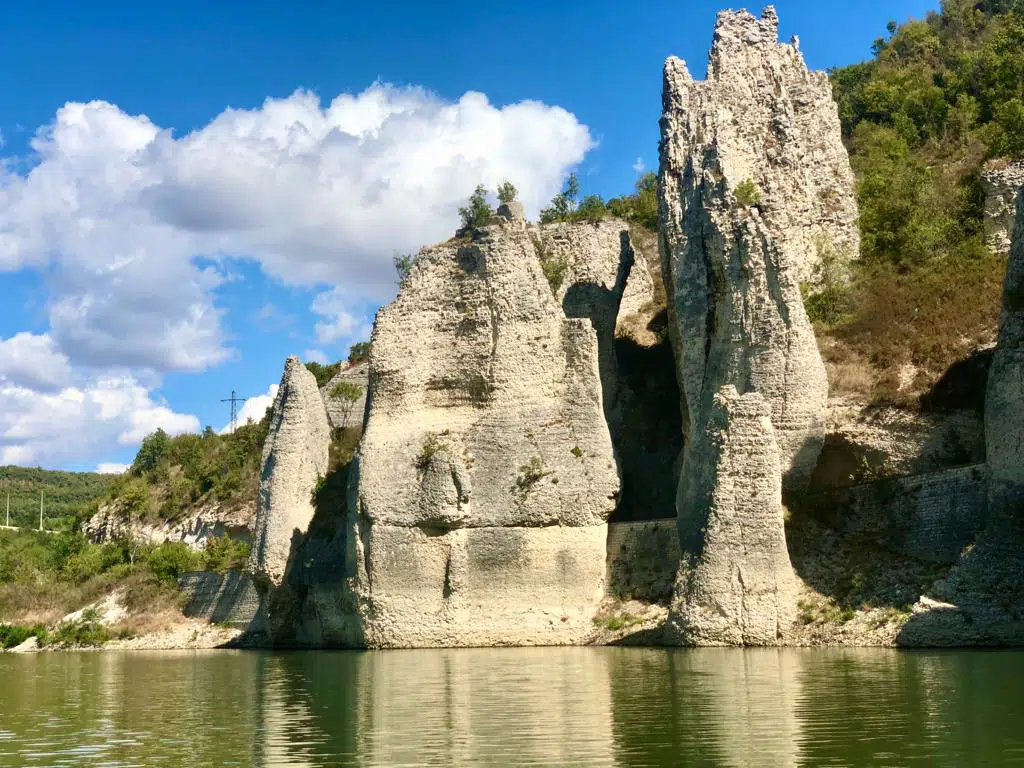
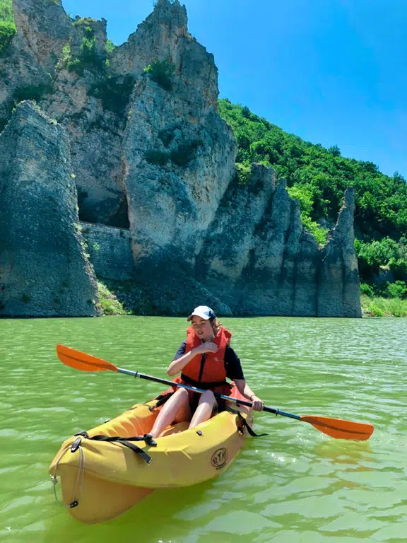
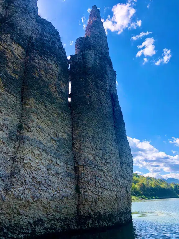
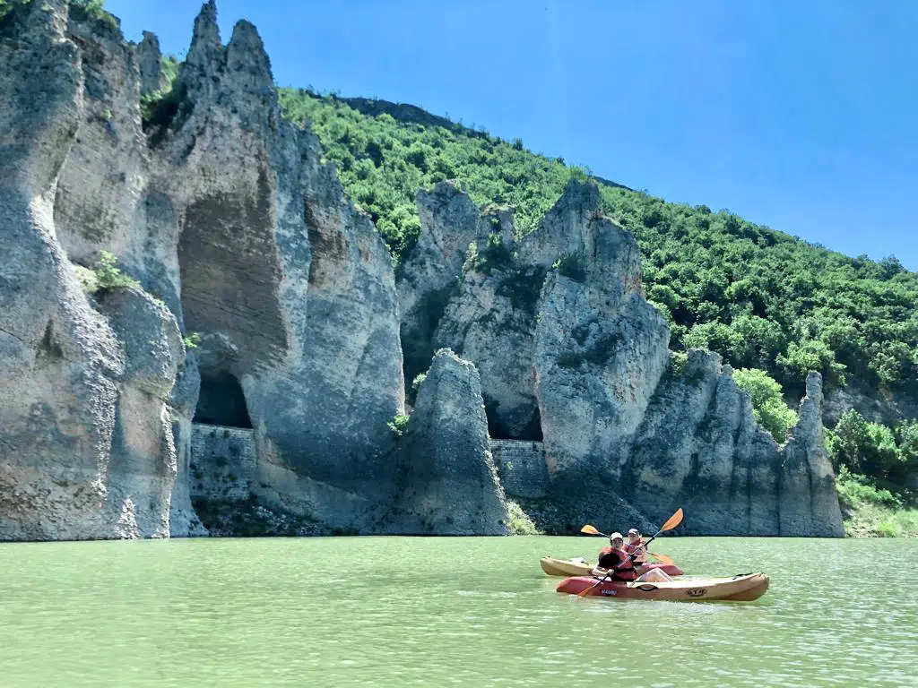
The Wonderful Rocks — a natural landmark between the Varna and Burgas regions
The Wonderful Rocks are among the most remarkable natural formations in Bulgaria, located on the shores of the picturesque Tsonevo Reservoir at the border of the Varna and Burgas regions. These impressive limestone cliffs have been shaped by centuries of erosion into towers, arches, and sharp, jagged ridges. Their striking silhouette against the calm waters of the reservoir creates unforgettable scenery and makes the location especially attractive to photographers and nature enthusiasts.
📍Some of the formations rise up to 40 meters. The site offers both visual beauty and geological significance, showcasing natural rock-forming processes that have taken place over thousands of years. The area is easy to access and suitable for both short visits and longer trips around the region.
🛣 How to get there
• By car: The Wonderful Rocks are located directly beside the road that runs along the Tsonevo Reservoir, making them easily accessible year-round.
• Five minutied by car from the Drive Point Hotel.🎯 Tourist tips
• Wear comfortable shoes — some areas can be rocky or uneven.
• Bring water and sun protection, especially in warmer months.
• Best time to visit: early morning or late afternoon for pleasant light.
• Be careful near the edges of the cliffs as they may be slippery.
• Respect the environment — do not leave litter or damage the formations.
-
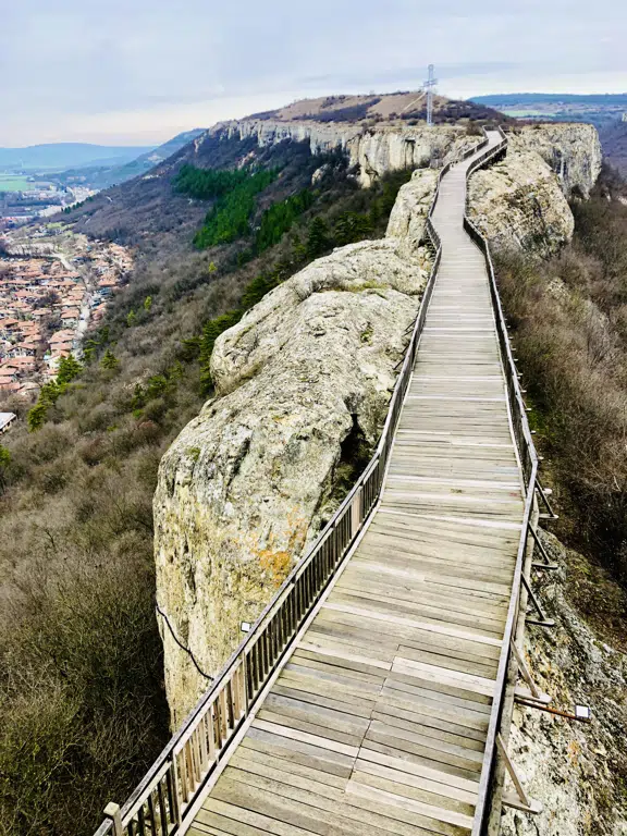
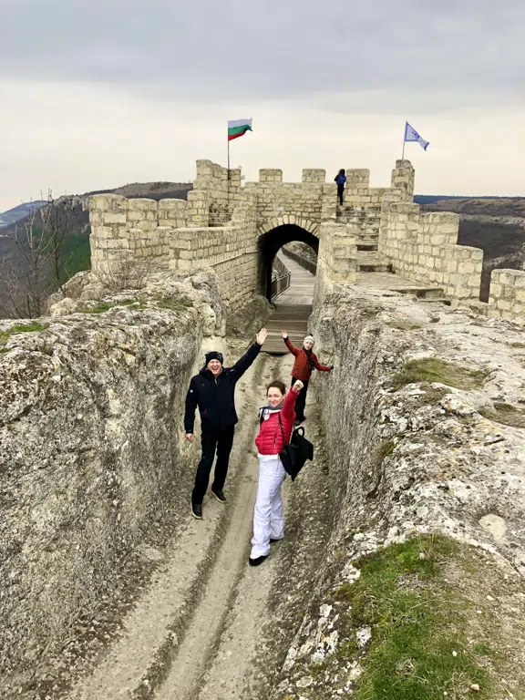
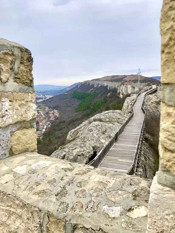
Ovech Fortress-an ancient fortress with a rich past!
Ovech Fortress, rising above the town of Provadia, is one of Bulgaria’s most remarkable historical landmarks. Built on a flat rock plateau, the fortress has served as a strategic stronghold throughout centuries, controlling key trade routes in the region. Its rich history spans Thracian, Roman, Byzantine, Medieval Bulgarian, and Ottoman eras.
📍One of the fortress’s most iconic features is the long wooden bridge that leads across the cliffs. It offers spectacular panoramic views of the town, the valley, and the surrounding rock formations. Visitors can explore the remains of watchtowers, medieval chambers, cisterns, and ancient carved passages.
🛣 How to get there
The most convenient way to reach the fortress is by car. From Drive Point Hotel in the village of Asparuhovo, located on the shore of the Tsonevo Reservoir, the drive takes about 30 minutes along a scenic route. A marked road leads to the top, where parking is available near the entrance. Visitors can also reach the fortress on foot from the center of Provadia via designated hiking paths.
🎯 Travel tips
Wear comfortable shoes — the terrain on the plateau is rocky.
Bring water and sun protection, especially in summer.
Best visiting time: early morning or late afternoon for ideal light and cooler temperatures.
The wooden bridge can be windy — take care when crossing.
The fortress plateau is perfect for panoramic photos and family-friendly walks.
-
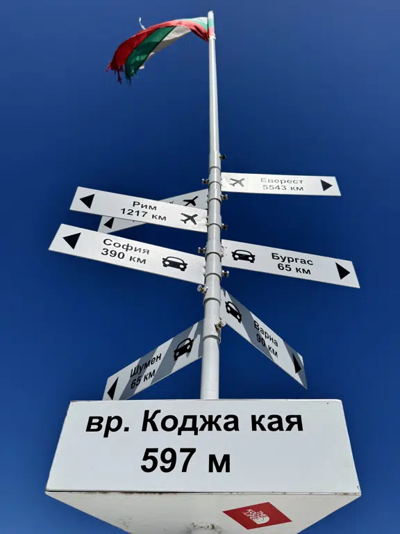
Eco Trail to Kodzha Kaya — gentle hiking in the Eastern Balkan Mountains
Eco Trail to Kodzha Kaya — gentle hiking in the Eastern Balkan Mountains
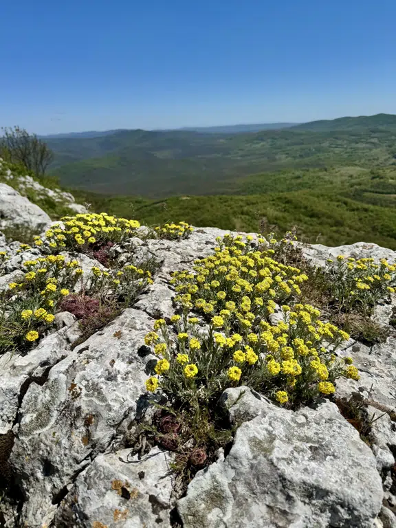
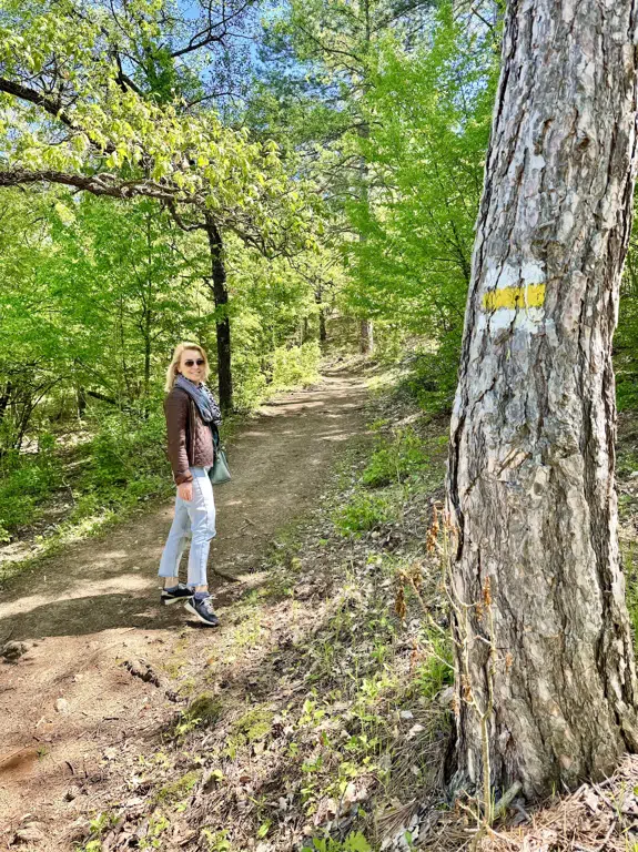
The Kodzha Kaya eco trail is located near the village of Bilka, in the eastern part of the Balkan Mountains — known as Eastern Stara Planina. This region is characterized by soft hills, forested slopes and calm natural surroundings, making it perfect for families and easy nature walks.
📍Why visit
an easy and family-friendly trail;
fresh air and peaceful natural landscapes;
characteristic hills and forests of the Eastern Balkans;
ideal for a short 1–2 hour hike.
Trail description
The path begins near Bilka and leads through forest terrain with a gentle upward slope. The final point, the Kodzha Kaya rock ridge, offers panoramic views of the wooded hills of the Eastern Balkan Mountains.
Interesting facts about Kodzha Kaya and the region
The name “Kodzha Kaya” comes from Ottoman Turkish meaning “big rock”, referring to its prominent appearance.
The area belongs to Eastern Stara Planina, the lower and gentler section of the Balkan range.
While Kodzha Kaya is not the ridge dividing Northern and Southern Bulgaria, it lies near this natural transition, where differences in climate and vegetation are noticeable.
Historically, the area was crossed by old shepherd and forest routes connecting small mountain settlements.
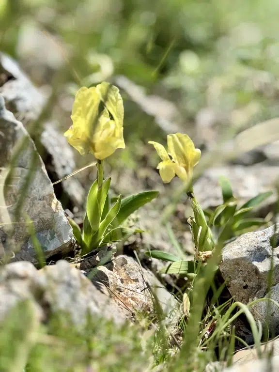
Nature here is rich: pine and oak forests, juniper, herbs, deer, foxes and many bird species.
🛣 How to get there
From Drive Point Hotel (Asparuhovo village) it takes about 10 minutes by car to reach the trailhead near Bilka.
Parking is available at the beginning of the route.🎯Traveler tips
wear comfortable hiking shoes;
bring water;
use sun protection in summer;
best time: morning or late afternoon;
- safe for children, but watch them on uneven terrain;
- respect nature and keep the area clean.
-
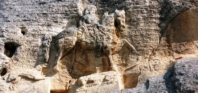
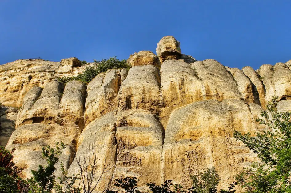
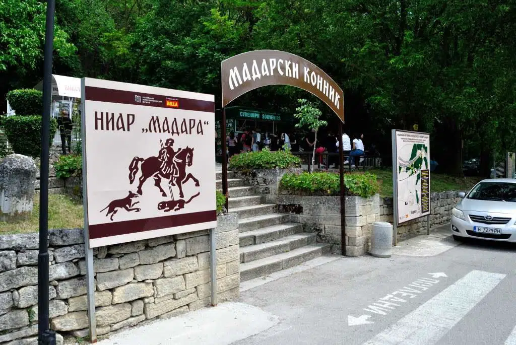
Madara Rider (Madarski konnik)
The Madara Rider it is a unique medieval relief carved on an almost vertical rock 100 meters high, near the village of Madara, in north-eastern Bulgaria. 23 meters above the ground is depicted a rider on a horse, piercing a lion with a spear, and behind him — a dog-a scene that impresses with its epic.
The relief dates back to the beginning of the century, from the time of the foundation of the first Bulgarian state, and is the only one of its kind in Europe. In 1979. The Madara Horseman is included in the list of world cultural heritage of the Apostille.
📍 Why visit it
- It is a unique historical and artistic monument, without analogue in Europe.
- The relief is not only a work of art, but also a historical source — the inscriptions around it tell about the rulers of early Bulgaria.
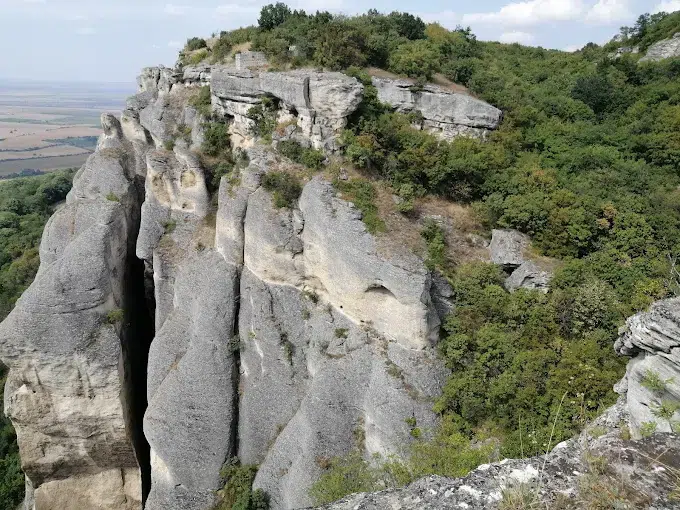
- The place is part of a natural and archaeological reserve — rocks, forests, caves, roads with thousands of years of history.
- Opportunity for strong impressions: nature + history + mystery of antiquity.
🛣 How to get there
From hotel (s. Asparuhovo, dam. Tsonevo) to the Madara Horseman the journey by car is about 1 hour.
The route passes through picturesque parts of Eastern Stara Planina and leads to the village of Madara, where there is a convenient parking. From there it continues on foot — by stairs and a path that lead to the rock Massif under the bas-relief.🎯 Tips for visitors
- OBcomfortable shoes — the terrain may be uneven;
- Go in the morning or at sunset for good photos and a more relaxed atmosphere;
- Go in the morning or at sunset for good photos and a more relaxed atmosphere;
- For details (inscriptions, scene) take binoculars — they are located high;
📜Historical facts
The relief was created at the beginning of the century, probably during Khan Tervel — one of the first and significant events in the newly established Bulgarian state.
The scene — a vadnik, a piercing lion – is considered not just a hunting scene, but a symbol of victory and power; according to some scholars-a victory over Byzantium.
In the area there are numerous rock caves and medieval churches and monasteries used in different eras. Now operates an archaeological museum with over 350 original finds.
In 2008. according to the results of a national poll – the Madara Horseman is chosen as a symbol of Bulgaria and is used on coins.
-
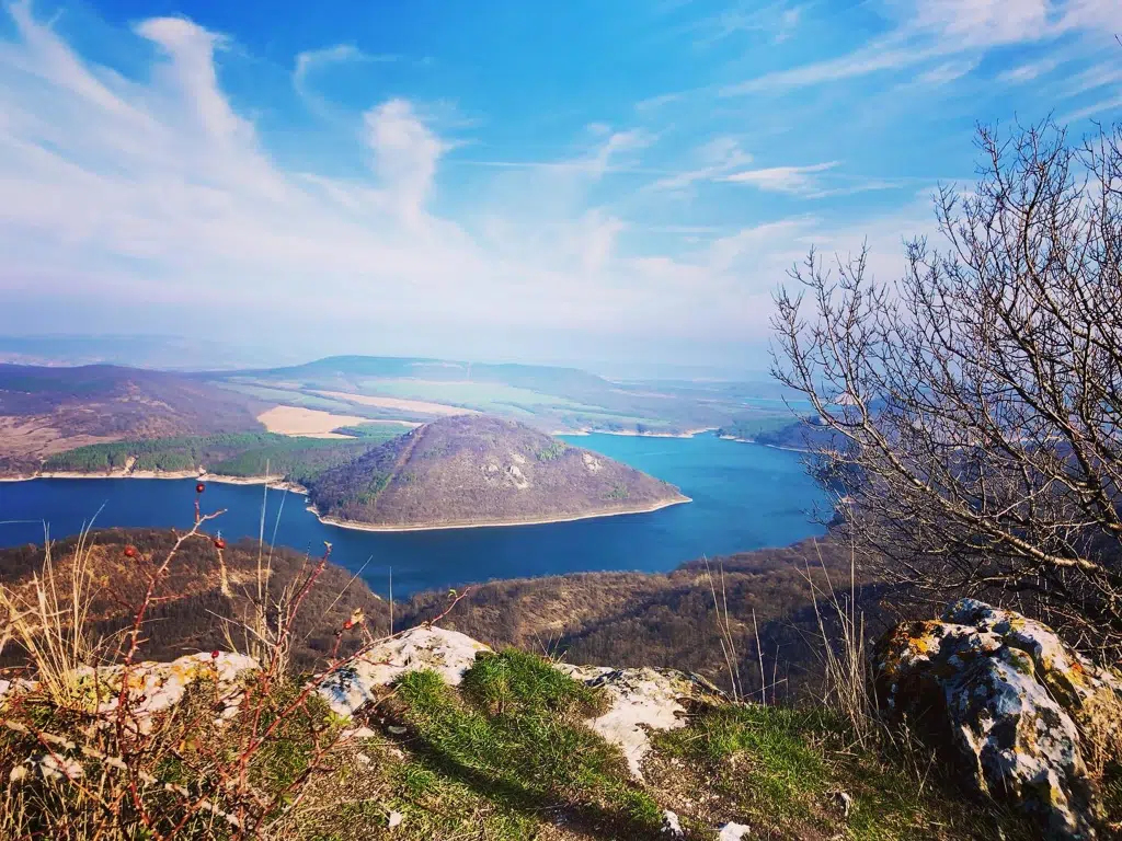
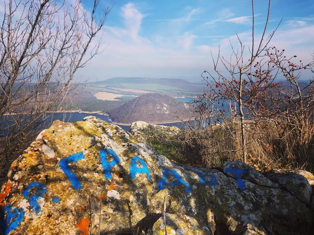
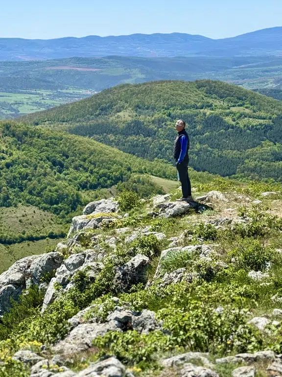
Eco Trail "peak Town"
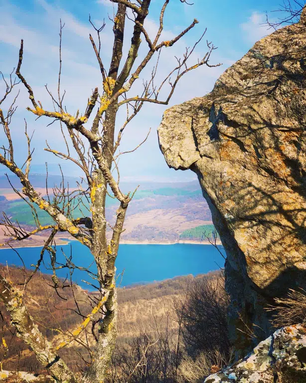
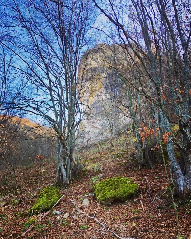
Eco Trail "The City Peak" it leads to a picturesque peak that reveals amazing panoramic views of Tsonevo dam and the Eastern Mountain. The place has an ancient atmosphere — it is believed that the peak was used as a natural fortress and observation point in different eras.
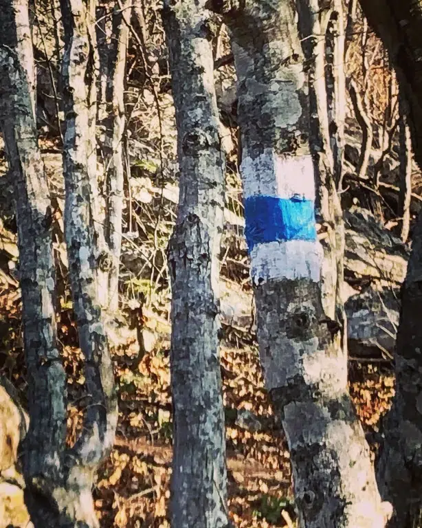
The path is well marked, with mixed terrain-forest areas, open slopes and rocky areas. It is considered to be moderately difficult, with several steep climbs, especially at the beginning and end before reaching the summit.
📍 Why visit it
- From the top is revealed one of the most beautiful views of Tsonevo dam.
- The route passes through picturesque parts of Eastern Stara Planina.
- It is suitable for active tourists and lovers of panoramic photos.
- Historical interest-the peak served as a natural fortification
- Excellent addition to other routes in the area such as the wonderful rocks or koja Kaya.
🛣 How to get there
From hotel (s. Asparuhovo, dam. Tsonevo) at the beginning of the trail there is about 10-12 minutes by car.
The starting point is not far from the waterfall, on the other side of the dam, and it can only be reached by car with high ground clearance, near the signpost for "peak City". The markings lead directly up the slope.🎯 Advice to tourists
- Cross the path only in dry weather - steep parts are slippery when wet.
- Must wear hiking shoes good grip.
- Take water, a hat and sun protection — in places the path is open.
- Suitable for families with older children.
- The top often blows — a light jacket is recommended.
📜 Interesting facts
- "The city" means fortress / gradishte the peak has been used for observation since ancient times.
- He is part of Eastern Stara Planina one of the oldest mountain ranges in Europe.
- The area was an important passage for ancient roads and routes.
- From the top you can see the unique shape of the tsonevo dam — the third largest in Bulgaria.